Automate Accurate Land Use Image Classification with AI
Achieve over 93% accuracy in land use image classification, eliminating manual review and significantly accelerating data categorization.
Manually classifying diverse images, such as satellite or aerial imagery, is a labor-intensive and inconsistent process that delays data analysis. This workflow automates high-accuracy land use image classification by leveraging AI embeddings and a K-Nearest Neighbors approach to instantly categorize images.
Documentation
Automate High-Accuracy Land Use Image Classification
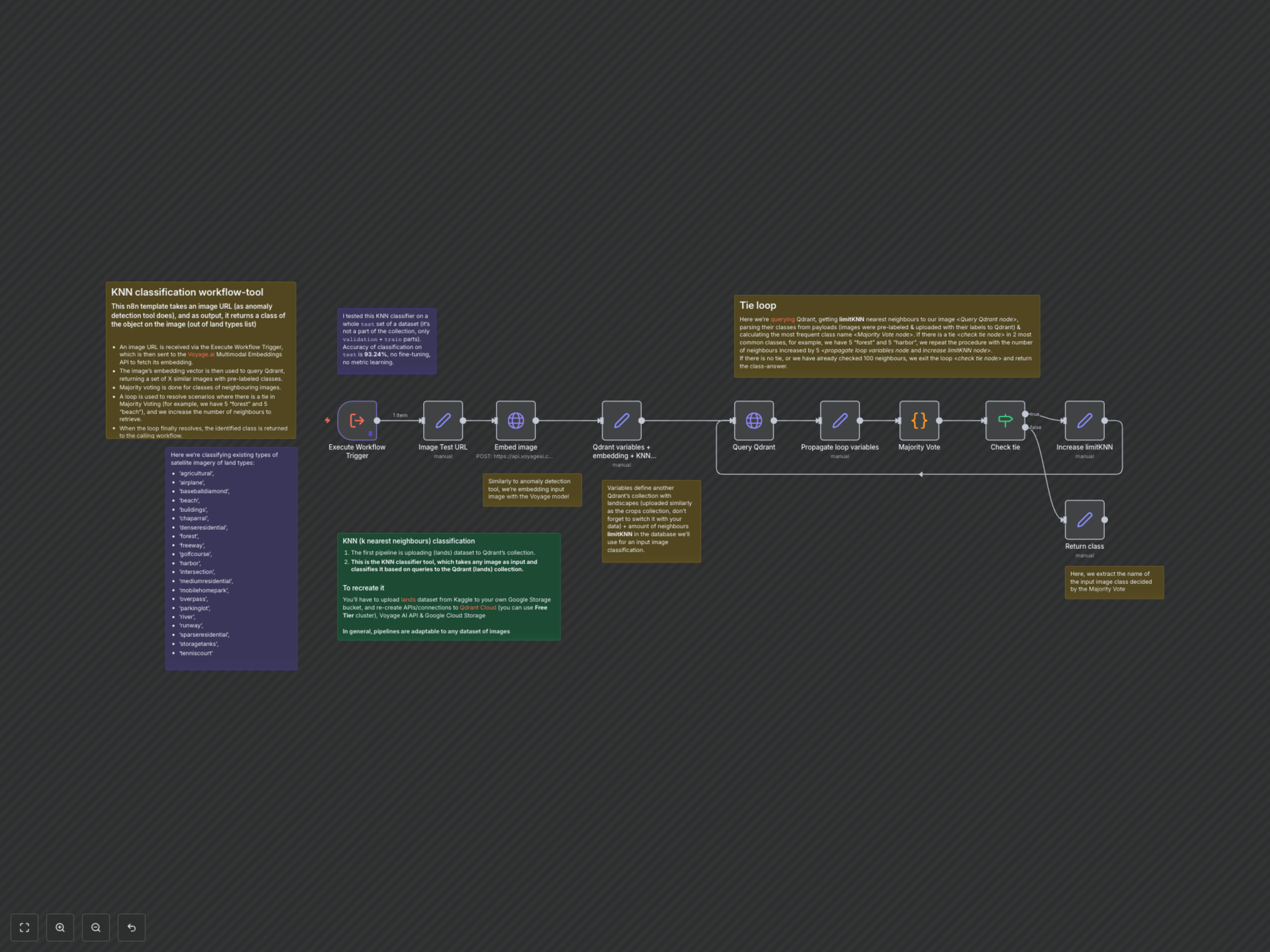
This n8n workflow provides a powerful, automated tool for classifying images based on land use types. By taking an image URL as input, it intelligently identifies the most probable category from a predefined list of land types, such as 'agricultural', 'forest', 'buildings', or 'river'. Ideal for GIS, environmental monitoring, or real estate applications, this solution streamlines the process of categorizing visual data with remarkable precision, achieving over 93% accuracy on a test set.
Key Features
- High-Accuracy Classification: Achieve over 93% classification accuracy on diverse land use images.
- AI-Powered Embeddings: Utilizes Voyage.ai's multimodal embeddings for robust image representation.
- Dynamic K-Nearest Neighbors (KNN): Queries Qdrant to find similar labeled images, automatically adjusting neighbor count to resolve classification ties.
- Broad Land Type Support: Classifies images across 21 distinct land use categories, from 'forest' to 'freeway'.
How It Works
This workflow is triggered by an input image URL. First, the image is sent to the Voyage.ai Multimodal Embeddings API to generate a high-dimensional vector representation. This embedding is then used to query your Qdrant vector database, which contains pre-indexed embeddings of labeled land use images. The workflow retrieves a set of K nearest neighbors and performs a majority vote on their assigned classes. In cases of a classification tie, the workflow dynamically increases the number of neighbors considered and re-evaluates until a clear majority is identified or a maximum limit is reached, ensuring a decisive classification output. Finally, the determined land use class is returned.